Award-winning outdoor navigation

Discover the outdoors like never before

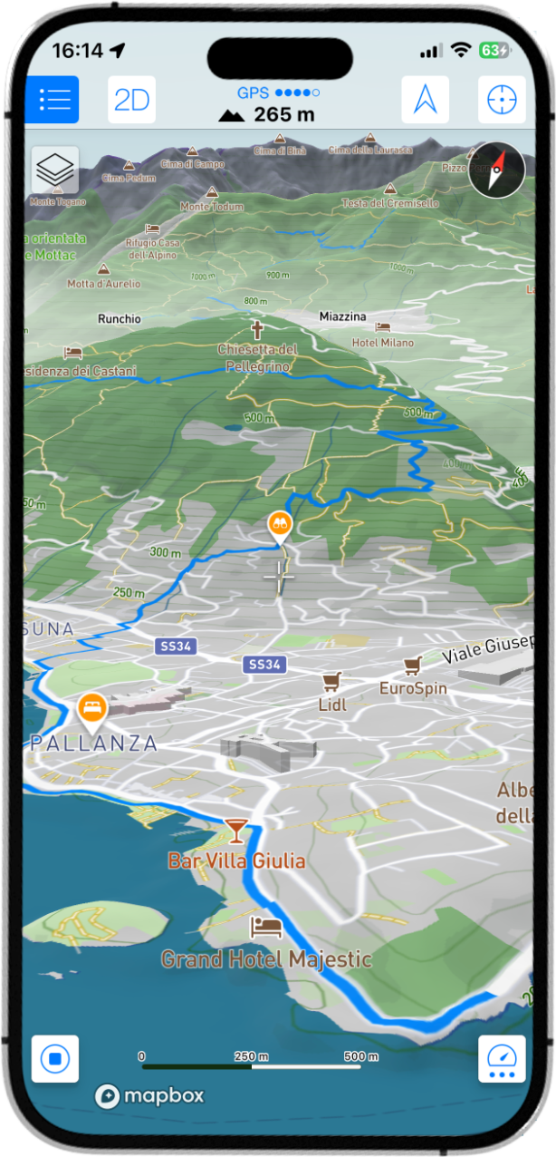
Maps 3D transforms the way you explore nature. Where traditional maps flatten mountains and valleys into contour lines, Maps 3D brings every landscape to life with stunning, interactive 3D terrain.

Maps 3D showing a 3D terrain map with a planned route
2.5M+ Adventurers worldwide
2011 Trusted since
Millions Points of interest
Worldwide Offline maps

Built for explorers

Understand the terrain before you set out

Whether you're hiking, cycling, trail running, mountain biking or simply discovering new places, Maps 3D helps you plan smarter routes, navigate with confidence, and experience every adventure from a whole new perspective.

Designed specifically for outdoor enthusiasts, Maps 3D combines beautiful 3D maps, worldwide offline navigation, powerful route planning and GPS recording into one seamless experience. Download maps before your trip, import GPX tracks, organize your adventures and keep exploring—even far beyond mobile coverage.

For more than a decade, over 2.5 million adventurers around the world have trusted Maps 3D to help them discover mountains, forests, valleys and trails with confidence.
Maps 3D 7

The biggest update in Maps 3D history

Maps 3D 7 introduces the most significant upgrade since the app first launched. Built on a completely redesigned vector map engine, every part of the experience has been reimagined to be faster, more beautiful and more immersive than ever before.

Everything you need outdoors

One app for the whole adventure

An all-new map engine

  • Stunning high-resolution 3D terrain
  • Fast, compact offline maps
  • Integrated satellite imagery
  • Crisp Retina graphics at every zoom level
  • Infinite zoom for maximum detail
  • Display multiple tracks simultaneously
  • Millions of searchable POIs with Wikipedia integration

Plan your adventures

Create, edit and optimize routes directly on the map with intuitive planning tools.

  • View elevation profiles before you go
  • Measure distance and elevation gain
  • Place custom waypoints anywhere
  • Organize tracks and waypoints into folders

Explore offline

Download maps before your trip and keep exploring without a mobile connection.

  • Worldwide offline maps
  • GPS recording with precise elevation data
  • Search maps even when offline
  • Reliable navigation in remote areas

Import and share

Bring your existing adventures into Maps 3D or share new ones with others.

  • Import GPX tracks from many sources
  • Export recorded routes
  • Share adventures with friends and fellow explorers

Your next adventure starts here

Join millions of explorers navigating the world in true 3D. Free to download on iPhone and iPad.

Download on the App Store